New FireQ Feature Alert
Amazing things happen when firefighters speak and those who serve them listen. The newest release of the FireQ software includes new features that came from firefighter suggestions, as well as a spiffy new look! Records management tools, firefighter response options, mapping tools and preplan accessibility all come together in one place in the FireQ solution.
Mapping for Firefighters
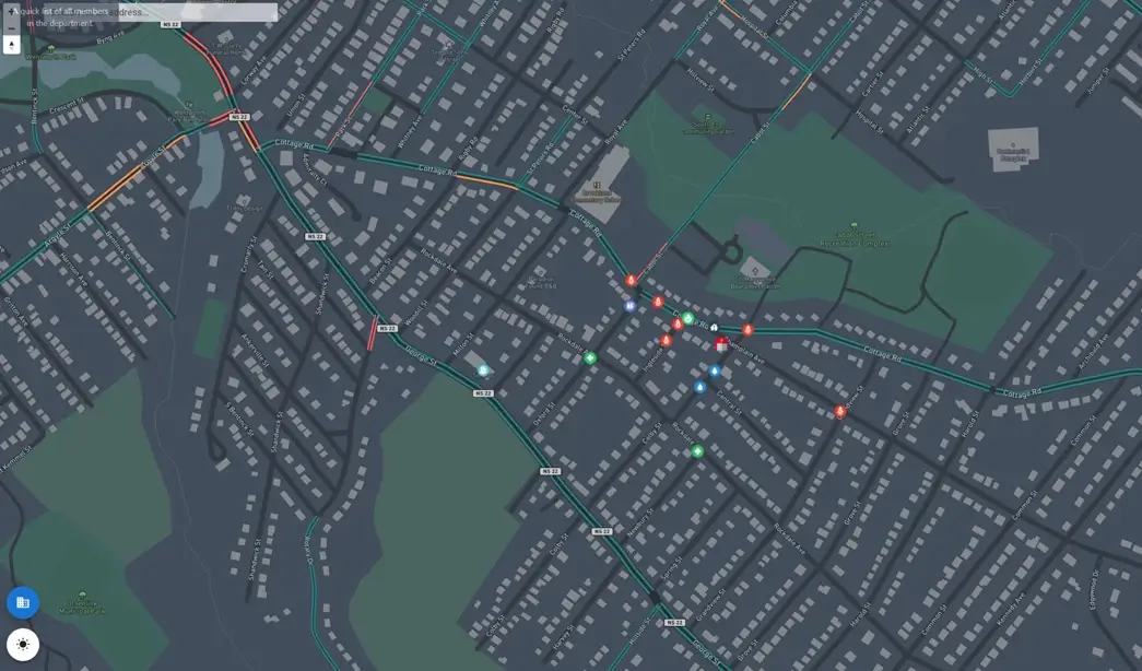
Technologically speaking, few things engage firefighters like mapping and the information those maps can provide. They want information to be easily and readily available; and they want that information to be relative to the location of an emergency incident. Because firefighters are awesome and we want them to have what they need, we made some changes to the FireQ mapping module and added a few things too.
New FireQ Feature – Responders on the Map
The new mapping module includes a firefighter tracking feature that provides added accountability for incident commanders and safety for firefighters, while also respecting the privacy of individual firefighters.

Firefighters and their movements appear on the map ONLY during an active incident and ONLY AFTER they have signaled their intent to respond.

Firefighters have the following choices about how they appear:
They can opt out entirely.
They decide when they appear on the map.
They appear on the map only when they arrive at the fire station.
Additionally, only firefighters who have been granted the necessary permissions will be able to see responders on the map. In many fire departments, this will be the Fire Chief and Incident Commanders.
New FireQ Feature – Map Search
Assets and hazards are now searchable and filterable in the FireQ Mapping Center. They can be viewed by category or search for a specific asset.

New FireQ Feature – Quick Map Orientation
Firefighters can now quickly re-orient to the fire station location on the map by clicking the FIRE STATION icon in the lower left corner of the map.
Improved Feature Makin’ It Pretty?
The latest FireQ update includes a few aesthetic features to make FireQ more pleasing to the eye.
Including a toggle for light and dark modes just made good sense. Dark mode offers relief for eye strain and reduces glare. Light mode, for some, can offer better visual performance.
Dark mode is currently available in the mapping and will be gradually added to other FireQ modules.

Tables and lists have been updated for easier viewing. The membership list clearly shows member availability status, as well as which firefighters have set up a FireQ profile and installed the app.


The training log list view details training, attendees, total training time and who attended.

The equipment list view shows, at a glance:
- The equipment and its serial number
- Where it is located
- To whom it has been assigned
- Expiry date, where relevant
The activity log view shows a list of department activities that are not incident response and not training. Again, it is possible to see a glace the details each activity as well as who attended.


